2020/05/28
Three-dimensional point cloud of slope failures in the Sensuikyo Valley (Aso City, Kumamoto, Japan) obtained by UAS-based SfM-MVS photogrammetry / UASとSfM多視点ステレオ写真測量を用いた3次元点群モデルの例(熊本県阿蘇市仙酔峡)
This is an example of 3D point cloud by Structure-from-Motion (SfM) Multi-View Stereo (MVS) photogrammetry. The 3D point cloud was produced from thousands of aerial photographs taken by small unmanned aerial vehicles (UAV), or unmanned aircraft or aerial system (UAS). The spectrum of colors indicates different information given to each point: red-green-blue (RGB) color, normalized differential vegetation index (NDVI) calculated using a near infrared camera data, topographic shade by eye-dome lighting (EDL), morphological roughness, and surface curvature. These data are readily obtained by SfM-MVS photogrammetry, and can be effectively used for various applications in geomorphology and related studies. For more details on SfM-MVS photogrammetry, see our review article in this issue (p. 321-343).
(Yuichi S. Hayakawa, Hiroyuki Obanawa, Hitoshi Saito, Shoichiro Uchiyama)
www.researchgate.net/publication/304674520_SfMduoshidians...
2020/05/21
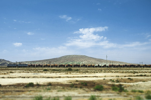
Dashgil Mud Volcano at Gobustan, Azerbaijan / ダシュギル泥火山(アゼルバイジャン共和国)
Numerous mud volcanoes are present in both offshore and onshore areas around Baku on the western coast of the Caspian Sea. Geomorphological studies have been carried out in the Dashgil Mud Volcano, located 50 km southwest of Baku, next to the Gobustan National Park that is a World Heritage with its cultural landscapes with prehistoric rock arts. The Dashgil has a 3-km diameter and 100-m summit elevation, and similar mud volcanoes are densely present in this region. "Dash (daş)" stands for rock or stone, while "gil" means clay. Normally, activities of these mud volcanoes are moderate with the continuous eruption of relatively cold materials including mud, water, and gas, but they can occasionally erupt massive gas to "explode" with flames hundreds of meters high.
カスピ海沿岸に位置するアゼルバイジャンの首都バクー周辺には、海底だけでなく陸上にも泥火山(でいかざん)が多数噴出している。地形学的な研究も行われているダシュギル泥火山は、バクーから南西に約50 km。近辺には、先史時代の岩絵などの文化的景観が世界遺産として登録されている、ゴブスタン国立保護区がある。ダシュギルは、直径3 km、標高100 m ほどの山であり、周辺にも同様の規模の泥火山が密に分布する。名称のダシュは石・岩、ギルは泥・粘土をあらわす。このような泥火山は、普段は穏やかに泥や水、ガスを噴出しているが、時折、何らかの要因で大量に放出されたガスが発火し、数百m もの高さの炎をともない「噴火」することがある。
(表紙写真:地形 38 (3), 2017)
2020/05/14
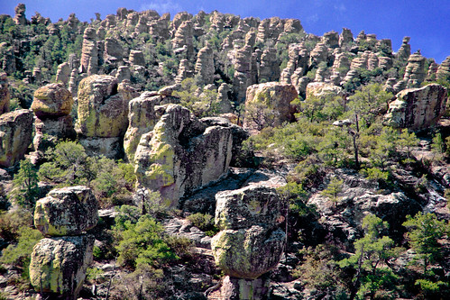
Hoodoos in Chiricahua National Monument, Arizona (USA) / チリカウワ国立公園の奇岩群(アメリカ合衆国)
A large amount of rock monuments, composed of rhyolite welded ignimbrite by the Turkey Creek caldera eruption 27 million years ago, are present in this arid hilly land. Weathering and erosion along weak lineaments (joints) caused the formation of the tors, some of which are gravitationally displaced but keep superb balance before collapsing. Extensive wildfire (Horseshoe Two Fire) occurred in May-June 2011 to burn ca. 90,000 ha in this area.
乾燥したアリゾナの台地に多数の岩が林立する。約2700万年前のターキークリークのカルデラ噴火による流紋岩質の溶結火砕流堆積物からなる。弱線沿いに風化と侵食が進み、傾きつつも絶妙なバランスで崩落を免れている岩も多く見られる。2011年5〜6月には大規模な山火事でこの付近の9万haが焼けた。
(表紙写真:地形 37 (2), 2016)
登録:
コメント (Atom)


